
Find out more about the wildfire and wildfire-related concerns in the NWT.

Home Attraction

Nataiinlaii Territorial Park Visitor Centre

Nitainlaii Territorial Park Visitor Centre in the Northwest territories

Perched on a cliff overlooking the Peel River, tucked in amongst the white birch and spruce trees, Nitaiinlaii Territorial Park is an ideal place to unwind after an epic journey on the Dempster Highway

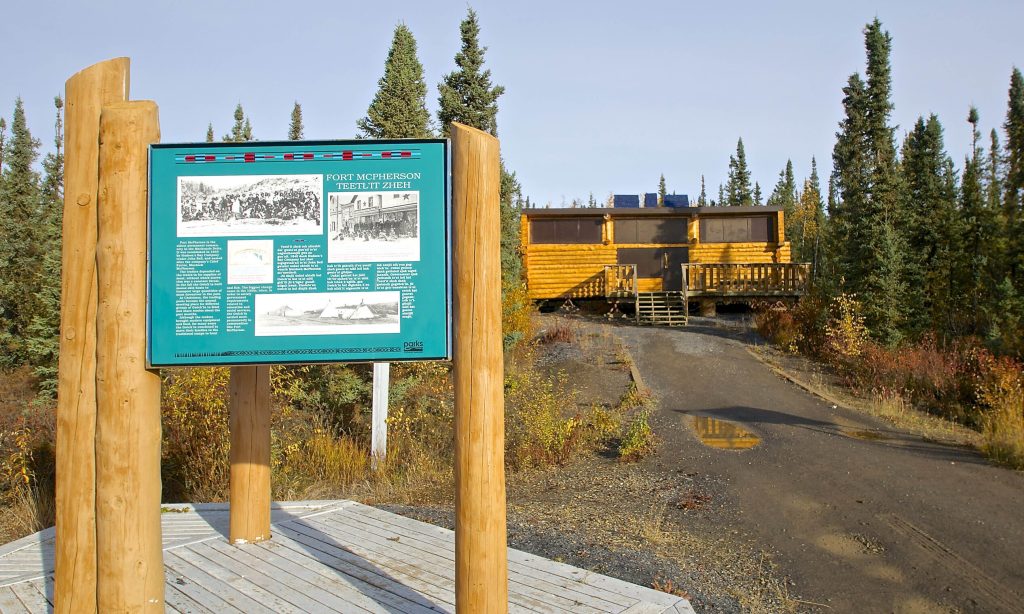
Though the park is best known as a campground, it’s also a popular picnic day-use area and rest stop. Just inside the entrance is a beautiful log building, cut from Peel River timber, which serves as an interpretive and information centre. It provides travellers information about the local area, exciting adventures to be had and current conditions of the Dempster. The interpretive centre also features historical displays detailing the rich culture and traditions of the Gwich’in people.

Nataiinlaii means “water flowing out in all directions” in the Gwich’in language. The Gwich’in were the first inhabitants of this area and the park is named after the waters here that served as their hunting and fishing grounds, as well as a vital transportation route.

There are 23 non-powered campsites in the park with picnic tables, fire pits and firewood. The site also features washrooms, a kitchen shelter, drinking water and on-site security. There’s no online booking for the camp, but sites are generally available at all times and can be booked upon arrival.

Nataiinlaii is located about 200 kilometres south of Inuvik at the 541 kilometre (Mile 336) point, only 76 kilometres after crossing the Yukon border.

Nataiinlaii Territorial Park

Nitainlaii Territorial Park

This park is perched on a cliff overlooking the Peel River and surrounded by stands of white birch and white spruce trees. It’s an ideal place to unwind for a few nights on the long journey up or down the Dempster. The visitor centre offers a fascinating glimpse of the life of the Gwich’in Dene people, past and present. There are 23 non-powered campsites here, plus washrooms, drinking water, a kitchen shelter and picnic area, and helpful staff.

Gwich’in Territorial Park

Gwich'in Territorial Park sign in the NWT

The Dempster Highway serves as a boundary for this 8,800-hectare park, which includes two campgrounds (Vadzaih Van Tshik Campground and Gwich’in Territorial Campground), two day-use areas (Ehjuu NJik and Nihtak) and Tithegeh Chii Vitaii Lookout. The park is home to a number of natural wonders of the Mackenzie Delta region: limestone cliffs, rare Arctic plant communities, migratory bird staging areas, and Campbell Lake, an excellent example of a reversing delta.

Happy Valley Territorial Park

Kitchen shelter in the Happy Valley Campground in the NWT

Located right in the heart of Inuvik, this gorgeous park and campground is situated on a bluff overlooking the east branch of the Mackenzie River and the breathtaking Richardson Mountains.

Hike through Happy Valley’s scenic wilderness, dip your line into the river for unmatched fishing, or paddle these beautiful waters in a canoe. Then, remind yourself that you’re only a block away from the hustle and bustle of the Town of Inuvik’s many arts and attractions.

The park is open from June through September and offers 19 powered and 15 non-powered campsites, along with washrooms, showers, drinking water, a kitchen shelter, picnic area, playground, 24-hour security and helpful staff.

Jàk Territorial Park

Scenery at Jàk Territorial Park in the Northwest territories

Located just outside of Inuvik, Jàk Territorial Park features an observation tower with excellent views of the surrounding scenery and prime bird-watching opportunities. Watch out for hoary redpolls, bald eagles, yellow-billed loons, and more summer residents of these northern skies.

Jàk comes from the Gwich’in word for “berry,” and true to its name there is an abundance of tasty local berries growing in the park, including wild cranberries, blueberries and cloudberries.

The campground offers six powered and 32 non-powered sites, along with washrooms and showers, drinking water, a kitchen shelter, picnic area, trails, interpretive displays and attentive staff. Camping reservations at Jàk Territorial Park can be made online.

Little Buffalo River Crossing Territorial Park

Little Buffalo River Campground in the Northwest Territories

Located on the scenic Little Buffalo River, about 20 kilometres shy of Fort Resolution and minutes away from Great Slave Lake, this placid campground features 20 powered campsites, washrooms, a kitchen shelter, picnic area and firewood. Take advantage of the boat launch to enjoy some watersports and excellent fishing. Dock your boat a few steps from your campsite.

Sambaa Deh Falls Territorial Park

SAmbaa Deh Falls in the Northwest Territories

A beloved attraction in the Dehcho, Sambaa Deh Falls Territorial Park is a must-see for any visitors travelling on Highway 1. Most visitors stop to photograph the roadside Sambaa Deh Falls, where the Trout River surges through a limestone slot and over a dazzling drop, but there’s plenty more to see if you follow the network of trails that trace the canyon rim.

Take a stroll 1.5-kilometres upstream and you’ll arrive at the beautiful Coral Falls, named for the numerous coral fossils still found in the area. Coral is a sweeter, shyer waterfall than Sambaa Deh, and one that you’ll likely have all to yourself. Downstream, meanwhile, the path will take you to the water, where you’ll find stellar fishing for Arctic Grayling and Pickerel. Please take care, because the rocks may be slippery when wet, and there are no fences.

The river here was a traditional transportation route before and during the fur trade. The falls forced travellers to portage around this dangerous stretch of water. Today, the park and campground contains hiking and walking trails, a viewing platform overlooking and 20 non-powered camping sites with washroom facilities.

Sambaa Deh Territorial Park is located along Highway 1, just a short drive from Fort Providence and Fort Simpson.

60th Parallel Territorial Park

The 60th parallel sign in the Northwest Territories

Adjacent to the visitor information centre, this park has a scenic picnic area overlooking the beautiful Hay River, plus seven non-powered campsites nestled amongst birch and aspen trees. Entering the Northwest Territories from Alberta, the friendly staff at the 60th Parallel are available to welcome you. The Visitor Information Centre is open from May 15 to September 15. Brochures, maps, fishing licences, camping permits, pay phone, drinking water, washrooms and fresh coffee area available. Aboriginal arts and crafts are on display in the centre. Audiovisual presentations depict the Northern way of life and what you might expect to see on your travels in the Northwest Territories.