Rivers, Mountains, and Cultural Connection in the Sahtu and Dehcho
At the edge of the Mackenzie Mountains, Nááts’ihch’oh National Park Reserve protects a landscape shaped by rivers, alpine peaks, wildlife, and longstanding cultural connection to the land. Located in the Southwest Northwest Territories, the park sits within the traditional territories of Shúhtaot’ine and Métis peoples, sharing deep connections with communities in both the Sahtu and Dehcho Regions.
Nááts’ihch’oh is a place of powerful scale and quiet presence. Glacial rivers cut through mountain valleys, caribou move across open terrain, and some of Canada’s most significant headwaters begin here. For travellers seeking remote paddling routes, multi-day hiking opportunities, and time on the land guided by local knowledge, the park offers a deeply immersive Northern experience.
While closely connected to nearby Nahanni National Park Reserve through geography and river systems, Nááts’ihch’oh stands on its own through its mountain landscapes, cultural significance, and remote backcountry experiences.
A Landscape Shaped by Story and Connection
The name Nááts’ihch’oh comes from the Shúhtaot’ine language and refers to a mountain that resembles a porcupine standing on its back legs. The mountain remains an important cultural landmark and reflects the deep relationships between people, language, and the land across the region.
The park was established through collaboration between Indigenous governments and Parks Canada, helping protect both ecological and cultural values across this part of the Mackenzie Mountains. Today, Indigenous stewardship continues to shape how the park is managed and experienced.
Travelling here means entering a landscape where stories, knowledge, and travel routes have connected communities for generations.
Rivers, Peaks, and Northern Landscapes
Nááts’ihch’oh National Park Reserve protects the headwaters of the South Nahanni River, one of the most celebrated river paddling destinations in the world. Snowmelt and glaciers feed clear mountain rivers that flow through broad valleys, alpine tundra, and dramatic canyon landscapes.
The park is also home to some of the Northwest Territories’ highest peaks, including Mount Nirvana, the tallest mountain in the territory. Jagged ridgelines, hanging valleys, and high alpine terrain define much of the landscape, creating exceptional opportunities for backcountry travel and photography.
These mountain systems support important wildlife habitat and form part of a larger connected ecosystem stretching across the Mackenzie Mountains.
Wildlife and Seasonal Experiences
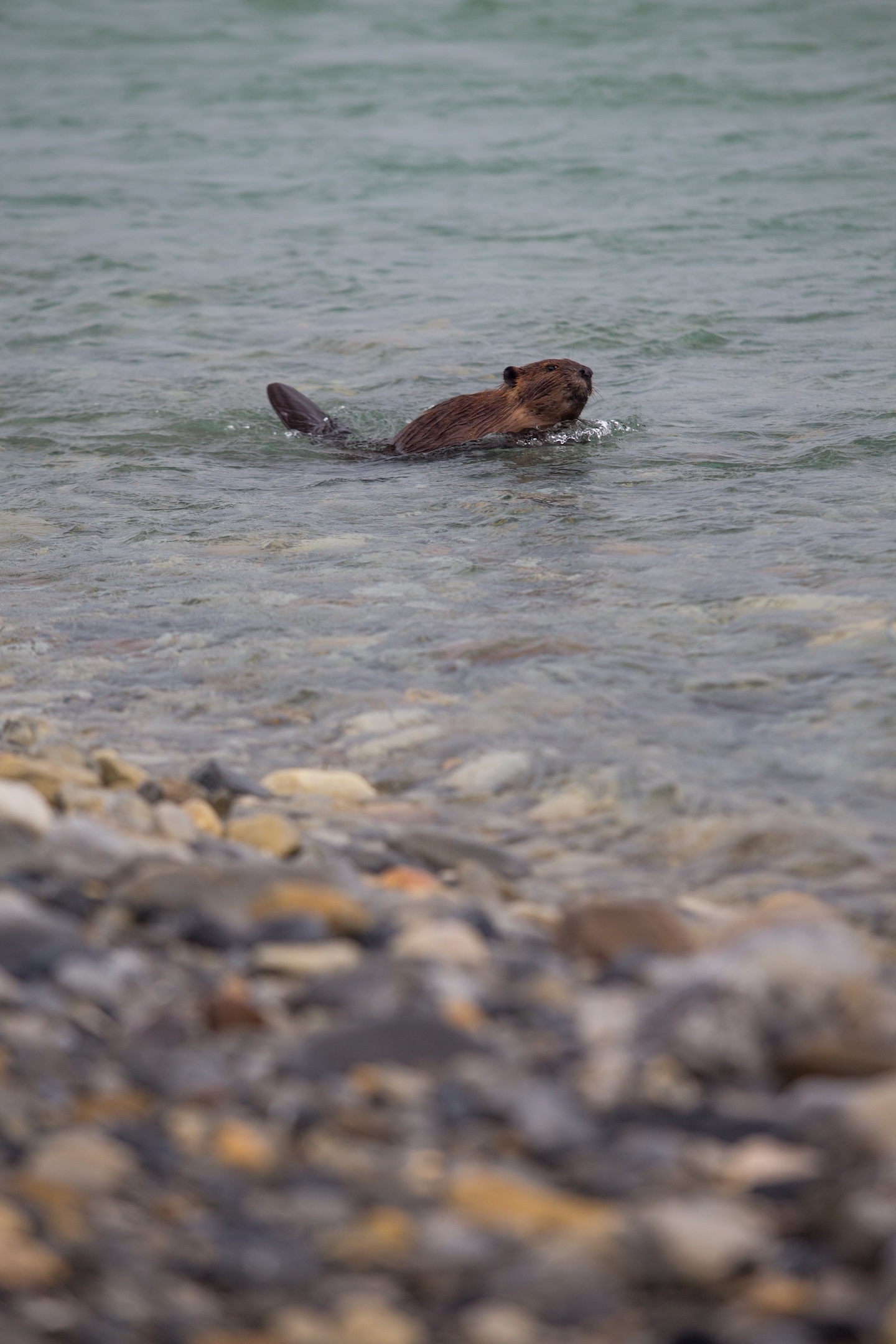
Wildlife viewing is one of the defining experiences of Nááts’ihch’oh. Dall’s sheep navigate steep mountain slopes, while moose, black bears, grizzly bears, wolves, and caribou move through valleys and river corridors.
Summer brings long daylight hours and accessible river travel conditions, while early autumn introduces vibrant tundra colours and cooler temperatures across the mountains. Seasonal changes arrive quickly in the North, shaping both wildlife movement and visitor experiences on the land.
Because of the park’s remoteness, wildlife encounters often happen naturally as part of travelling through the landscape rather than at designated viewing areas.
Paddling, Hiking, and Backcountry Adventure
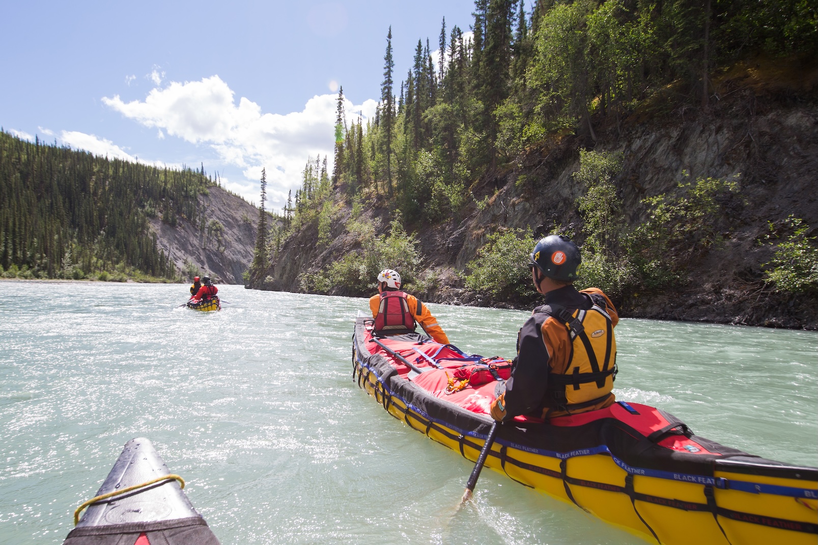
For many visitors, river paddling is the heart of the Nááts’ihch’oh experience. Multi-day canoe and raft expeditions travel through the upper South Nahanni watershed, combining whitewater, canyon scenery, and remote camping.
Outfitters operating in the region provide guided river trips, logistics support, and fly-in access for travellers unfamiliar with Northern backcountry conditions. Some routes continue downstream into Nahanni National Park Reserve, allowing visitors to experience both parks within a single journey.
Backcountry hiking and mountaineering opportunities are also available for experienced travellers. Alpine routes near Mount Nirvana and Glacier Lake offer challenging terrain, expansive views, and opportunities for extended wilderness travel.
Due to the remote environment and lack of established infrastructure, most visitors travel with experienced guides or outfitters familiar with the region’s conditions and safety requirements.
How to Visit Nááts’ihch’oh
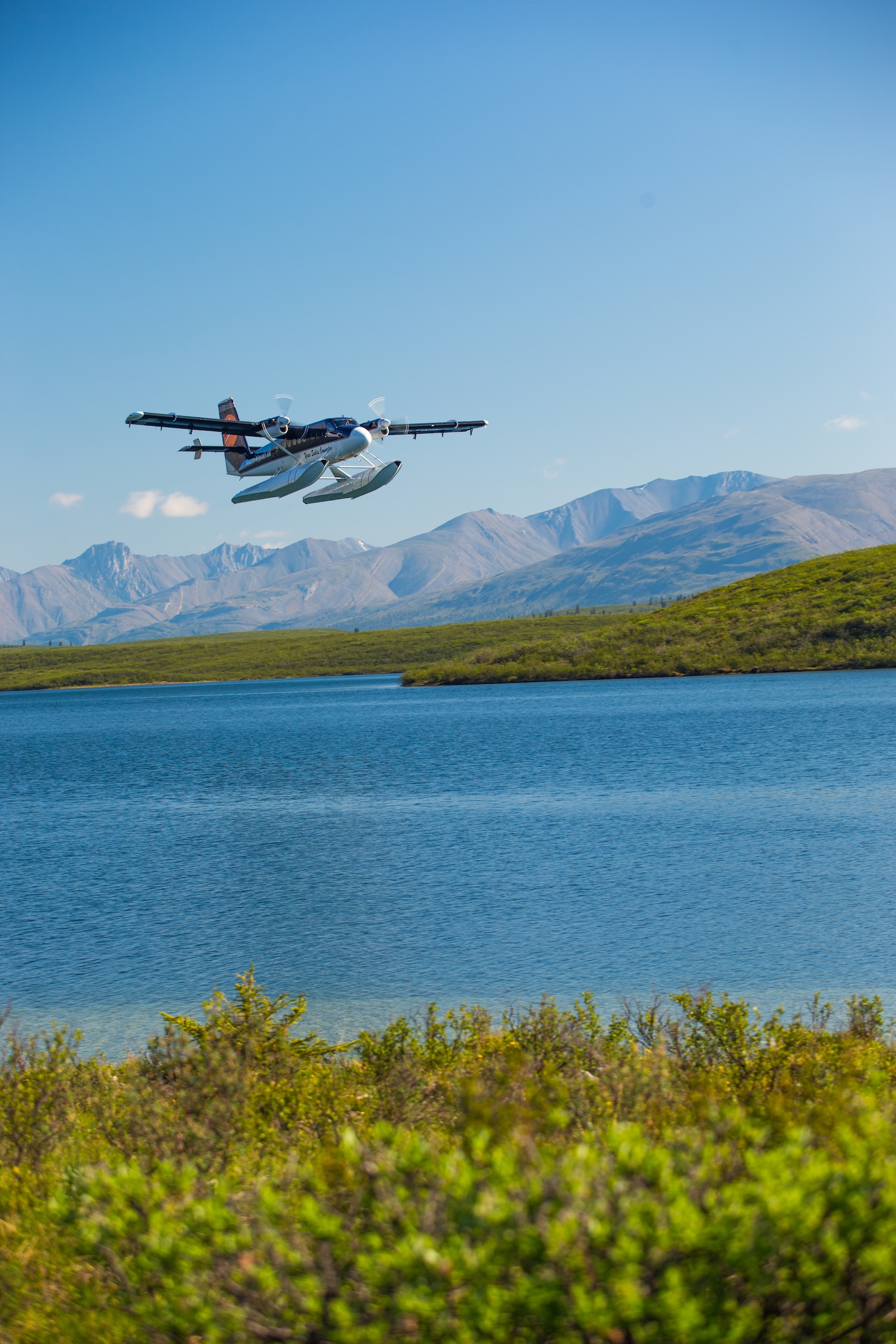
Nááts’ihch’oh is one of the most remote national park reserves in Canada. There are no roads into the park, and most visitors arrive by charter aircraft or floatplane from communities such as Tulita, Norman Wells, or Fort Simpson.
Flying into the park is part of the experience. Floatplanes land on remote mountain lakes and rivers, offering access to paddling routes, hiking areas and backcountry camps far beyond road networks. Charter flights also provide aerial views of the Mackenzie Mountains, braided river valleys, and alpine terrain that define the region.
Planning ahead is essential. Visitors should expect wilderness conditions, rapidly changing weather, and limited communications infrastructure. Guided trips and outfitted expeditions are the most common way to experience the park safely and responsibly, with many outfitters coordinating charter flights, gear transport and route logistics.
Popular ways to visit:
- Guided paddling expeditions on the South Nahanni River
- Fly-in hiking and backcountry camping trips
- Wildlife viewing and photography excursions
- Multi-park itineraries combining Nááts’ihch’oh and Nahanni National Park Reserve
Visitors should register with Parks Canada before entering the park and review current safety guidance and travel recommendations.
Best Time to Visit Nááts’ihch’oh
Most travel takes place between June and September, when rivers are accessible and weather conditions are more suitable for paddling and hiking.
June brings long daylight hours, active wildlife, and strong river flows from snowmelt across the Mackenzie Mountains. July and August are typically the warmest months, with daytime highs often ranging from 15°C to 25°C, making them the most popular time for paddling and backcountry travel.
By late August and early September, temperatures begin to cool and alpine valleys shift into vibrant fall colours. Nighttime lows can drop close to freezing, especially at higher elevations, creating crisp mornings and changing conditions across the park.
Because mountain weather can shift quickly at any point in the season, travellers should prepare for rain, wind, and cold temperatures even during mid-summer.
Communities Near Nááts’ihch’oh National Park Reserve
Several Northwest Territories communities serve as starting points for trips into Nááts’ihch’oh National Park Reserve.
Tulita is located where the Mackenzie and Great Bear Rivers meet, and is one of the primary gateways into the park and an important community connected to the Sahtu Region and Shúhtaot’ine culture.
Fort Simpson, in the Dehcho Region, is a common starting point for guided Nahanni and Nááts’ihch’oh expeditions, with charter flights and outfitting services available during the summer season.
Norman Wells provides additional charter access into the Mackenzie Mountains and supports some guided backcountry trips into the park.
Plan Your Trip
Nááts’ihch’oh National Park Reserve offers a rare opportunity to travel through mountain landscapes shaped by rivers, wildlife, and cultural connection to the land. Whether you are planning a multi-day paddling expedition or seeking a deeper experience in the Mackenzie Mountains, careful preparation and local expertise are essential.
Explore guided trips, connect with local outfitters, and begin planning your journey into one of the Northwest Territories’ most remote protected areas.